


Cant de Gal - Treviso

ARPF
User
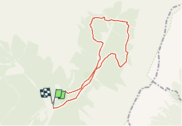

Length
8.4 km

Max alt
1717 m

Uphill gradient
742 m
Km-Effort
18.2 km

Min alt
1178 m

Downhill gradient
722 m
Boucle
Yes
Creation date :
2018-06-26 16:53:56.456
Updated on :
2018-06-26 16:53:56.456
7m
Difficulty : Difficult

FREE GPS app for hiking
 SityTrail
IGN / Geographical institutes
SityTrail Plus
The world is yours!
About
Trail Walking of 8.4 km to be discovered at Trentino-Alto Adige/Südtirol, Provincia di Trento, Primiero San Martino di Castrozza. This trail is proposed by ARPF.
Description
Dessin
Positioning
Country:
Italy
Region :
Trentino-Alto Adige/Südtirol
Department/Province :
Provincia di Trento
Municipality :
Primiero San Martino di Castrozza
Location:
Unknown
Start:(Dec)
Start:(UTM)
721947 ; 5122246 (32T) N.
Comments